Topics
Dr. Lena Halounová, Czech Technical University:
Integration of GIS and Remote Sensing for Water Management and Mining Applications
Dr. Roger L. King, Mississippi State University:
Semantic based image mining
Scientific Challenges in Information Retrieval from Earth Observation Imagery
Dr. Martin Isenburg, Rapidlasso (Assistant: Ms. Anahita Khosravipour, ITC Enschede & University of Twente):LiDAR Processing with Examples of Different Projects
Hands-on Workshop: The typical Steps of a LiDAR Processing Workflow
Dr. Claudia Notarnicola, EURAC-Institute of Applied Remote Sensing:
Retrieval of Essential Climate Variables (ECV) from remotely sensed data: advanced methodologies, applications and future perspectives
Dr. Marinko Oluić, University of Zagreb:
Remote sensing for the Earth Sciences
Dr. Susan L. Ustin, University of California:
Imaging Spectroscopy: Measurement of Vegetation Properties
Dr. Nicolas Younan, Mississippi State University:
Moderator in the Panel Discussion
Lecturers:
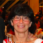
Dr. Lena Halounova
Dr. Lena Halounova is Associate professor at the Faculty of Civil Engineering at the Czech Technical University in Prague and head of the Remote Sensing Laboratory. She has courses in remote sensing, GIS and image processing. She is author of more than one hundred scientific papers. Her projects are focused on application of remote sensing in water management, hazards in geology and GIS modelling in geology and other branches. She has been involved in EARSeL being a member of the Bureau, and ISPRS. She was elected Congress Director of the XXIII ISPRS Congress, which will take place in Prague in 2016.
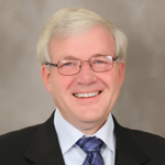
Dr. Roger L. King
Dr. Roger L. King received his BS from West Virginia University (1973) and his MS from the University of Pittsburgh (1978) in electrical engineering. He received his Ph.D. in engineering from the University of Wales – Cardiff (1988).
He began his career with Westinghouse Electric Corporation, but soon moved to the U.S. Bureau of Mines Pittsburgh Mining and Safety Research Center. Upon receiving his Ph.D. in 1988 he accepted a position in the Department of Electrical and Computer Engineering at Mississippi State University where he holds the position of William L. Giles Distinguished Professor. At Mississippi State University, Dr. King presently serves as the Director of the Center for Advanced Vehicular Systems in the Bagley College of Engineering. He has also served as the Associate Dean for Research and Graduate Studies and as the Director of the US Department of Transportation funded National Consortium on Remote Sensing in Transportation – Environmental Assessments. Dr. King is a member of Tau Beta Pi, Phi Beta Kappa, Sigma Xi, and Eta Kappa Nu.
Dr. King has received numerous awards for his research including the Department of Interior’s Meritorious Service Medal. Over the last 40 years, Dr. King has served in a variety of leadership roles with the IEEE Industry Applications Society, Power and Energy Society, and Geosciences and Remote Sensing. He has served for 4 years as the Chair of the IEEE GRSS Data Archiving and Distribution Technical Committee and served as a member of the IEEE GRSS AdCom. He also served as the Co-Technical Chair for IGARSS 09 in Cape Town, South Africa. He is a member of the European Image Information Mining Coordination Group (IIMCG) and a Fellow of IEEE. Dr. King is a registered professional engineer in the state of Mississippi.
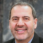
Dr. Nicolas H. Younan
Dr. Nicolas H. Younan is currently the Department Head and James Worth Bagley Chair of Electrical and Computer Engineering at Mississippi State University. He received the B.S. and M.S. degrees from Mississippi State University, in 1982 and 1984, respectively, and the Ph.D. degree from Ohio University in 1988. Dr. Younan’s research interests include signal processing and pattern recognition. He has been involved in the development of advanced image processing and pattern recognition algorithms for remote sensing applications, image/data fusion, feature extraction and classification, automatic target recognition/identification, and image information/data mining.
Dr. Younan has published over 200 papers in refereed journals and conference proceedings, and book chapters. He has served as the General Chair and Editor for the 4th IASTED International Conference on Signal and Image Processing, Co-Editor for the 3rd International Workshop on the Analysis of Multi-Temporal Remote Sensing Images, Guest Editor, Pattern Recognition Letters, and JSTARS, and Co-Chair, Workshop on Pattern Recognition for Remote sensing (2008-2010). He is a senior member of IEEE and a member of the IEEE Geoscience and Remote Sensing society, serving on two technical committees: Image Analysis and Data Fusion, and Earth Science Informatics (previously Data Archive and Distribution). He also served as the Vice Chair of the International Association on Pattern Recognition (IAPR) Technical Committee 7 on Remote Sensing (2008-2010), and Executive Committee Member of the International Conference on High Voltage Engineering and Applications (2010-2014).
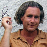
Dr. Isenburg
Dr. Isenburg received his MSc in 1999 from the University of British Columbia in Vancouver, Canada and his PhD in 2004 from the University of North Carolina at Chapel Hill, USA – both in Computer Science. Currently, he is an independent scientist, lecturer, and research consultant. Dr. Isenburg has created a popular suite of LiDAR processing software modules called LAStools that is the flagship product of rapidlasso GmbH, the company he founded in 2012. The LAStools software suite has deep market penetration and is heavily used in industry, government agencies, research labs, and educational institutions. These highly efficient LiDAR processing tools are known for their high productivity. They combine robust algorithms with efficient I/O and clever memory management to achieve high throughput for data sets containing billions of points. See http://rapidlasso.com for more information.
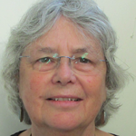
Dr. Susan L. Ustin
Dr. Susan L. Ustin received a B.S. and M.A. in Biological Science at California State University Hayward in 1974 and 1978, respectively, and a Ph.D. in Botany from the University of California Davis in 1983. She is a Professor in the Department of Land, Air, and Water Resources at the University of California Davis and Director of the Center for Spatial Technologies and Remote Sensing (CSTARS). She has published nearly 300 research papers in journals and scientific proceedings. Her research interests include applications of imaging spectroscopy, quantifying and mapping physiologically active canopy biochemical using airborne and satellite instruments. She is currently a member of NASA’s MODIS and HyspIRI science teams. She is the recipient of several awards including an Honorary Doctorate from University of Zurich in 2010, Fellow, the Remote Sensing Society in 2004, Outstanding Service, American Society of Photogrammetry and Remote Sensing in 2004.
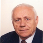
Dr. Marinko Oluic
Dr. Marinko Oluic is Professor at the Faculty of Mining, Geology and Petroleum Engineering, University of Zagreb, and an adviser in the GEOSAT company, Zagreb. Graduated Engineer in Geology, University of Zagreb, Croatia (1961). Specialization: Application of Remote Sensing and Photogrammetry in Geology, Institute for Geodesy and Photogrammetry, Bergakademie, Freiberg, Germany (1965). Dr. of natural sciences, scientific field Geology, Humboldt University Berlin, Germany (1973). Associate professor (1975), full professor (1988) Faculty of Mining, Geology and Petroleum Engineering, University of Zagreb. Chairman of the Commission for Geology and Geophysic, Council for Remote Sensing, Yugoslav Academy of Sciences and Arts (1979-1989). Vice Chairman oft he Scientific Council for Remote Sensing in Croatian Academy of Sciences and Arts (1989-1997). Representative of Croatia in EARSeL (2003 -→). Representative of Croatia in EU Commission – GMES Expert Forum (2012 -2013). Project manager and principal investigator of several domestic and international projects. Partner in EU Project OBSERVE (2010-2012). 2004: Organizer of the 24th EARSeL Symposium in Dubrovnik, Croatia. 2008: Organizer of the 1st EARSeL Conference, Zadar Croatia. Author of more then 120 scientific and professional publications, and of 5 books, mostly in the field of Geoinformation (remote sensing and GIS).
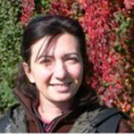
Dr. Claudia Notarnicola
Dr. Claudia Notarnicola received the Degree in Physics, summa cum laude, and the PhD in Physics from the University of Bari (Italy) in 1995 and 2002 respectively.
She is presently the vice-head of the EURAC-Institute of Applied Remote Sensing (Bolzano, Italy). Within the same institute she is leader of a group dealing with remote sensing applications in SAR and optical domain for soil and vegetation monitoring as well as integration of remotely sensed observations with models and ground measurements. Her main research interest includes biophysical parameters (soil moisture, vegetation, snow) retrieval by using optical images and SAR images, optical and SAR data processing, data fusion and electromagnetic models. She conducts research on these topics within the frameworks of several national and international projects. Among the others, she is involved in the Cassini-Huygens Project for the application of inversion procedure to the estimation of Titan surface parameters. She is a referee for IEEE and other international journals and since 2006, she serves as Conference Chairs for SPIE International Conference on “SAR Image Analysis, Modeling and Techniques”.
